How does GPS work today and stay accurate worldwide?
TL;DR
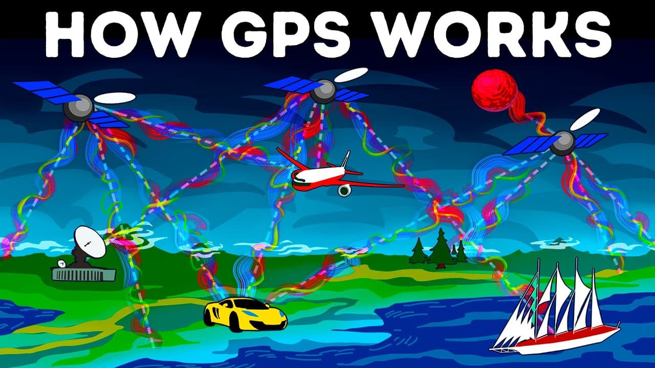
GPS is a system of satellites, ground stations, and receivers that calculates your location by trilateration using signals from at least four satellites. Civilian access became free in 2000, and accuracy improves with more satellites and corrections from clocks. Time signals from GPS synchronize systems globally.
Transcript
Once upon a time, your ancestors used to look at the night sky to determine their location. Then we used a Thomas Guide, remember those? Today, it only takes one magical technology to get driving directions, send your picnic spot to a lost friend, or track how far you’ve gone during a workout. That technology is called GPS, and you’re about to find... Read More
Key Insights
- GPS is a three-part system of satellites, ground stations, and receivers.
- Ground stations confirm satellite positions to ensure data accuracy.
- Receivers compute location by measuring distance to at least four satellites.
- Trilateration is used for 2-D positions and for 3-D positions, altitude is included.
- GPS satellites carry atomic clocks but receivers use quartz clocks updated from signals.
- Civilian GPS became fully available for free in May 2000.
- There are 32 active satellites with 24 core satellites in operation.
- Accuracy improves as more satellites are used and as orbital data are updated.
- More videos from this channel:
- More from this channel: BRIGHT SIDE
Install to Summarize YouTube Videos and Get Transcripts
Explore YouTube Video Summarizer or Get YouTube Transcript Extractor
Questions & Answers
Q: How does GPS trilateration determine your location with four satellites?
GPS trilateration uses the known positions of at least four satellites and the measured distance from the receiver to each satellite to pinpoint a location. The receiver compares signal travel times to calculate distances, then uses the intersection of spheres around each satellite to determine a precise latitude, longitude, and altitude. This method reduces ambiguity and yields accurate positioning even when moving. The system relies on the predictable orbits and time synchronization provided by satellites, ground stations, and receivers to maintain consistency across different environments.
Q: What makes GPS accurate enough for civilian use?
Civilian GPS accuracy comes from using signals from multiple satellites and correcting time data through the almanac information and satellite orbit predictions. A receiver needs four satellites to remove timing errors and determine precise position. The GPS time signals are synchronized and updated to keep position calculations consistent, while relativistic effects are accounted for to prevent drift. This combination enables reliable, everyday navigation for maps, driving, and tracking activities.
Q: Why are atomic clocks on GPS satellites important?
Atomic clocks on GPS satellites keep extremely precise time, which is essential for calculating how far signals have traveled to reach the receiver. Accurate timing allows the receiver to determine distance to each satellite and, when combined with four satellites, compute exact location. Without precise time, even tiny errors would accumulate, leading to significant positional inaccuracies over time.
Q: When did GPS become available to civilians for free, and why is this important?
GPS became available to civilians for free in May 2000. This opened up global positioning capabilities beyond military use, enabling widespread consumer navigation, mapping, and timing applications. Free civilian access accelerated innovation in smartphones, vehicles, and Internet services that rely on precise location and synchronized time signals for operations and data integrity.
Q: How many GPS satellites are currently active and how are they organized?
There are 32 active GPS satellites orbiting the Earth, with 24 core satellites and the rest as emergency replacements. This arrangement ensures coverage and redundancy so that receivers can see at least four satellites from most locations. Regular maintenance and orbital updates keep the system accurate and reliable for navigation and timing.
Q: What role do GLONASS satellites play with GPS receivers?
Many modern receivers rely on both GPS and GLONASS satellites to improve accuracy and coverage worldwide. By combining signals from multiple global navigation satellite systems, receivers can maintain precise location even when visibility to GPS satellites is limited. This interoperability enhances reliability in challenging environments like urban canyons or deep canyons.
Q: What challenges can GPS face in practice?
Even with high precision, GPS can lead users astray in rural areas when roads are ambiguous or misinterpreted by the system, such as routes that lead to non roads like boat launches or water hazards. Obstacles like weather, atmospheric conditions, or signal obstructions can also affect accuracy. Users should verify routes and use common sense when following directions in unfamiliar terrain.
Q: How precise is GPS time and why is that important for critical systems?
GPS provides time signals accurate within 10 billionths of a second, essential for synchronized operations across banks, power grids, and cellular networks. The combination of satellites’ atomic clocks and receiver corrections ensures global time consistency, enabling reliable timestamping and coordination in critical infrastructure and financial transactions.
Summary & Key Takeaways
-
GPS comprises satellites, ground stations, and receivers to determine location. Ground stations verify satellite positions with radars, while receivers measure distances to satellites to trilaterate 2-D or 3-D position.
-
The system relies on four or more satellites to resolve position and time, using signals and the speed of light to compute precise coordinates.
-
GPS time signals and almanac data enable global navigation, accuracy within feet or inches, and synchronization for banks, power grids, and cellular networks.
Read in Other Languages (beta)
Share This Summary 📚
Summarize YouTube Videos and Get Video Transcripts with 1-Click
Try YouTube Summary with ChatGPT & Claude or YouTube Transcript Generator
Explore More Summaries from BRIGHT SIDE 📚





Summarize YouTube Videos and Get Video Transcripts with 1-Click
Try YouTube Summary with ChatGPT & Claude or YouTube Transcript Generator