How does North Korea map its secretive society?
TL;DR
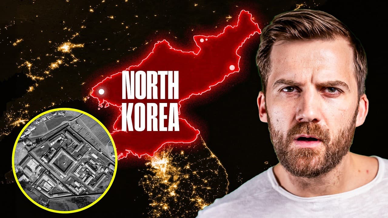
Satellite mapping reveals a fortress like layout with thousands of military installations, hidden tunnels, and strict internal barriers. It shows how leadership uses a network of bases, checkpoints, and surveillance to control the population, while experts provide context to broaden the understanding beyond common perceptions.
Transcript
- Testing 1, 2, 3, 4, 5. (image chiming) If you point a camera at the Earth, 600 kilometers above the surface, it's pretty mesmerizing. (image chiming) But point it at the Korean peninsula and you'll see this. South Korea is ablaze, but North Korea is almost totally dark, you've got this little point here for Pyongyang, the capital, but it's mostly... Read More
Key Insights
- 25 million people live in North Korea, and the country centers its design around military and control
- North Korea operates 10 000 plus manned military installations across its territory
- The DMZ is a four kilometer thick border with thousands of landmines and a heavy artillery threat aimed at Seoul
- There are 1 000 observation posts and 300 checkpoints and roadblocks to monitor and manage movement
- North Korea maintains over 1 million soldiers and a major focus on air defense and tunnels
- Underground tunnels and mountain bunkers provide strategic mobility and protection for the regime
- The Kim family security apparatus includes 100 000 bodyguards and a hill that houses armored transport and escape routes
- Mount Paektu is a sacred mountain on the border with China, symbolically tying geography to identity
- More videos from this channel:
- More from this channel: Johnny Harris
Install to Summarize YouTube Videos and Get Transcripts
Explore YouTube Video Summarizer or Get YouTube Transcript Extractor
Questions & Answers
Q: A real search query question about the video (e.g. 'How to...', 'What is...', 'Why does...', 'When should...'). Question 1
What does satellite mapping reveal about how North Korea is organized and controlled? The map highlights a fortress like layout with extensive military installations underground tunnels and barriers that shape daily life. It shows how the leadership uses military strength surveillance and carefully designed infrastructure to manage the population and deter external threats, while experts add historical and strategic context.
Q: Question 2
How many military facilities are there and how are they distributed? The video notes over 10 000 manned military installations concentrated especially near the DMZ and southern border, with a dense network of air defense bases naval sites and tunnels. This distribution underscores North Korea’s emphasis on deterrence and rapid mobilization capabilities.
Q: Question 3
What threat is posed by the DMZ and artillery near Seoul? The DMZ is described as a four kilometer thick border with thousands of landmines and 900 artillery guns aimed at Seoul. In a conflict these guns could fire at high rates, making the southern capital a primary strategic target and shaping political calculations for both sides.
Q: Question 4
Why are tunnels such a central feature of North Korea’s defense? Tunnels serve multiple purposes including invasion routes they can be used to move troops quickly under the DMZ and protect bases from air power. They reflect a defensive mindset built from the memory of destruction during the Korean War and continued emphasis on preparedness.
Q: Question 5
How does the video describe the leadership’s security and mobility options? The Kim family is protected by about 100 000 bodyguards and the hill where military installations sit includes an armored train and helicopters stored inside. This configuration demonstrates a high level of personal protection and contingency planning for the ruling family.
Q: Question 6
What role do geography and landmarks play in the narrative of the map? Mount Paektu is described as sacred and partly on the Chinese side, linking geography to national mythology. The video uses mountains rivers and border locations to illustrate how space is organized to reinforce ideology and control.
Q: Question 7
What is the broader purpose of turning satellite data into a narrative about North Korea? The aim is to fill in blanks in public knowledge by showing how cities, factories, housing, water slides, schools and markets are arranged within a security driven framework. This helps viewers understand daily life under a restrictive regime.
Q: Question 8
What caveats come with using maps to understand North Korea? While maps reveal many infrastructure details and defense priorities they cannot capture every aspect of society or political dynamics. The video stresses that maps are one piece of a larger puzzle supplemented by expert analysis and on the ground research.
Summary & Key Takeaways
-
The video uses satellite imagery and expert analysis to explain how North Korea is organized around military power, surveillance, and isolated communities. It highlights the extensive defense infrastructure, from DMZ fortifications to underground tunnels, and explains how the leadership set up systems to manage and control the masses.
-
The narrator notes that the country is beautiful yet highly fortified, with barriers and checkpoints designed to keep people in and to protect the ruling family. The map is used to fill in gaps in public knowledge by showing hidden aspects of society, economy, and daily life.
-
The conclusion emphasizes that data from maps and experts can broaden perspectives on a secretive nation, while acknowledging that the map cannot capture every detail.
Read in Other Languages (beta)
Share This Summary 📚
Summarize YouTube Videos and Get Video Transcripts with 1-Click
Try YouTube Summary with ChatGPT & Claude or YouTube Transcript Generator
Explore More Summaries from Johnny Harris 📚





Summarize YouTube Videos and Get Video Transcripts with 1-Click
Try YouTube Summary with ChatGPT & Claude or YouTube Transcript Generator