Why Are All World Maps Distorted and Misleading?
TL;DR
All world maps are distorted due to the challenge of representing the Earth's spherical surface on a flat plane, leading to trade-offs in shape, size, and direction. The Mercator projection is useful for navigation as it preserves direction but distorts land size, while the Gall-Peters projection accurately represents area at the cost of shape distortion. Modern cartographers often prefer projections like the Winkel Tripel for a balanced view.
Transcript
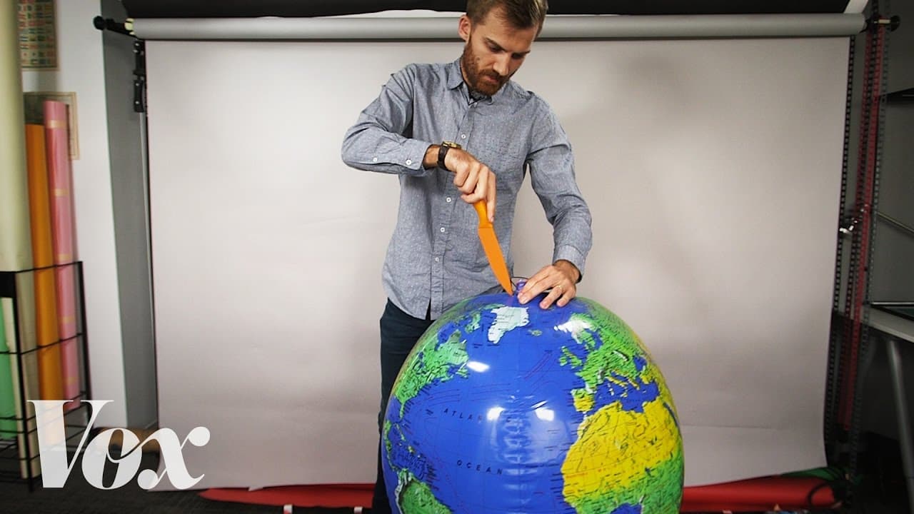
If I want to turn this globe into a flat map, I’m going to have to cut it open. In order to get this to look anything like a rectangle. I've had to cut it in places. I've had to stretch it so that the countries look all wonky. And even still, it's almost impossible to get it to lie flat. And that right there is the eternal dilemma of map makers: Th... Read More
Key Insights
- Map-making involves converting the spherical surface of the Earth into a flat representation, which inevitably leads to distortions in shape, distance, direction, or area.
- The Mercator projection is historically significant for navigation because it preserves direction, allowing navigators to plot straight-line courses using a compass.
- A major criticism of the Mercator projection is its distortion of size, particularly near the poles, which can perpetuate misleading perceptions of the size of countries.
- The Gall-Peters projection addresses the issue of area distortion by preserving land area, but it significantly distorts the shape of countries, making them appear stretched.
- Modern cartography has shifted from navigational needs to aesthetic and design considerations due to the advent of GPS technology, which provides accurate navigation without reliance on paper maps.
- Web mapping tools like Google Maps still use the Mercator projection because it maintains shape and angles, which is useful for city-level navigation.
- The Winkel Tripel projection is favored by many modern cartographers for its balanced representation of size and shape, offering a compromise between different types of distortion.
- There is no single correct map projection; each serves different purposes and involves trade-offs, highlighting the importance of choosing the right projection for the intended use.
Install to Summarize YouTube Videos and Get Transcripts
Explore YouTube Video Summarizer or Get YouTube Transcript Extractor
Questions & Answers
Q: Why can't a globe be accurately represented as a flat map?
A globe cannot be accurately represented as a flat map because the Earth's surface is spherical, and flattening it requires some form of distortion. This is due to the mathematical impossibility of projecting a three-dimensional surface onto a two-dimensional plane without altering certain attributes such as shape, size, distance, or direction.
Q: What is the main advantage of the Mercator projection?
The main advantage of the Mercator projection is its ability to preserve direction, making it invaluable for navigation. It allows navigators to draw straight lines between two points, which correspond to constant compass bearings, thus simplifying the process of plotting courses across the ocean.
Q: What is a significant criticism of the Mercator projection?
A significant criticism of the Mercator projection is its distortion of size, particularly near the poles. This distortion can lead to misconceptions about the relative size of countries, such as making Greenland appear comparable in size to Africa, when in reality, Africa is much larger.
Q: How does the Gall-Peters projection differ from the Mercator projection?
The Gall-Peters projection differs from the Mercator projection in that it preserves land area, providing a more accurate representation of the relative size of countries. However, this comes at the cost of distorting the shape of countries, making them appear stretched, especially near the equator.
Q: Why do modern cartographers prefer the Winkel Tripel projection?
Modern cartographers prefer the Winkel Tripel projection because it offers a compromise between preserving size and shape, providing a more balanced representation of the Earth's surface. It minimizes distortion in both areas and shapes, making it a popular choice for world maps in educational and reference materials.
Q: How has GPS technology impacted the use of map projections?
GPS technology has significantly impacted the use of map projections by reducing the reliance on paper maps for navigation. With accurate, real-time location data available from satellites, the focus of cartography has shifted from navigational accuracy to considerations of aesthetics and design in map-making.
Q: Why do web mapping tools like Google Maps still use the Mercator projection?
Web mapping tools like Google Maps still use the Mercator projection because it preserves shape and angles, which is essential for accurate navigation at a city level. This feature ensures that directional cues, such as 90-degree turns, are accurately represented, aiding users in navigating urban environments.
Q: What is the key takeaway regarding the use of different map projections?
The key takeaway regarding the use of different map projections is that there is no single correct projection. Each projection involves trade-offs, preserving certain attributes while distorting others. The choice of projection depends on the specific needs and purposes, whether for navigation, educational, or aesthetic purposes.
Summary & Key Takeaways
-
Map projections are necessary to create flat representations of Earth's spherical surface, but they all involve some form of distortion. The Mercator projection is useful for navigation due to its preservation of direction, though it distorts the size of land masses, particularly near the poles.
-
The Gall-Peters projection provides a more accurate representation of land area, but at the cost of distorting the shape of countries. As GPS technology has reduced the need for navigational maps, modern cartography focuses more on aesthetics and design.
-
No single map projection is perfect, and each involves trade-offs between shape, size, distance, and direction. The Winkel Tripel projection is often used for its balanced representation, but the most accurate depiction of Earth remains the globe.
Read in Other Languages (beta)
Share This Summary 📚
Summarize YouTube Videos and Get Video Transcripts with 1-Click
Try YouTube Summary with ChatGPT & Claude or YouTube Transcript Generator
Explore More Summaries from Vox 📚

Summarize YouTube Videos and Get Video Transcripts with 1-Click
Try YouTube Summary with ChatGPT & Claude or YouTube Transcript Generator