Why Is China's 2023 Map Angering Its Neighbors?
TL;DR
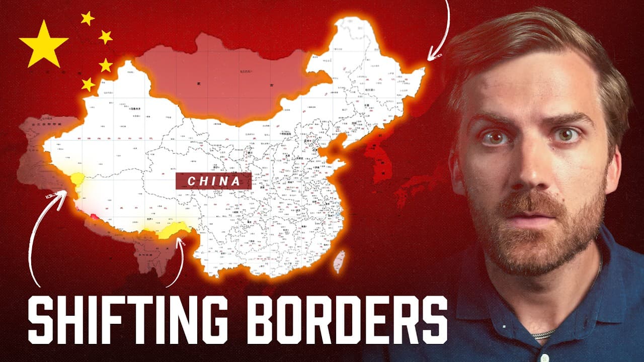
China's 2023 standard map claims disputed territory across its entire region, from Kashmir and Arunachal Pradesh to the South China Sea and Taiwan. Neighboring countries rejected it as overstepping their borders. The map shows how cartography functions as a tool of national power, asserting control through renamed places, encroaching construction, and blurred boundary lines.
Transcript
- [Johnny] On August 28th, 2023, the Chinese government released a map. The map did a surprisingly good job at making a lot of other countries angry. - [Reporter 1] Several countries have rejected China's new standard map. - It's a violation of the law. That's where I put that map. - [Johnny] The release of this map also was met with a huge event a... Read More
Key Insights
- China released its standard map on August 28th, 2023, which prompted several countries to reject it, while Chinese state media warned that maps with errors can cause 'great harm to society' and framed accurate maps as key to national unity.
- China requires its mapmakers to use an algorithm that intentionally scrambles the latitude and longitude coordinates of maps in the name of national security, making Chinese maps difficult for outsiders to align with other mapping systems.
- The India-China border in the Himalayas is marked by the Line of Actual Control, a boundary never really agreed upon, where both nations build roads, towers, and airfields to prepare for potential conflict.
- The 2020 clash near Ladakh killed 20 Indian soldiers and four Chinese soldiers, fought with stones, bamboo poles, and barbed-wire-wrapped clubs because the two nuclear countries agreed not to use firearms in the high mountains.
- China pressured Bhutan into conceding mountain territory in 2006 and uses the same playbook elsewhere, blurring borders and building roads and settlements on sovereign Bhutanese land to fortify its claims.
- The Doklam Plateau matters strategically because it gives China a military vantage point over the 'chicken neck,' the thin corridor connecting India to its eastern states, making India vulnerable in a conflict.
- China claims Arunachal Pradesh as 'South Tibet,' rejecting the 890-kilometer borderline a British representative drew in 1913 with a Tibetan representative, and is renaming mountains, rivers, and cities in the region.
- India is countering China's claims by spending half a billion dollars to build roads and develop hundreds of villages, aiming to solidify its hold on the disputed territory.
Install to Summarize YouTube Videos and Get Transcripts
Explore YouTube Video Summarizer or Get YouTube Transcript Extractor
Questions & Answers
Q: Why did China release a new standard map in 2023?
The Chinese government released its standard map on August 28th, 2023, and paired it with a major state media event emphasizing the importance of maps. State media warned citizens that maps containing errors can cause 'great harm to society' and framed accurate cartography as key to national unity. The video argues the map is a tool China uses to assert and project power across its region, claiming disputed territory as its own.
Q: Why are countries angry about China's 2023 map?
Several countries rejected China's new standard map because they believe it oversteps China's boundaries and claims land that belongs to them. The map asserts Chinese ownership over disputed regions including Kashmir, Arunachal Pradesh, parts of Bhutan, the South China Sea, the Senkaku Islands, and Taiwan. Neighbors condemned it as a violation, and the release triggered diplomatic pushback across the region because it formalizes China's territorial claims on paper.
Q: What is the Line of Actual Control between India and China?
The Line of Actual Control is the boundary that loosely marks the border between India and China in the Himalayas, a border that was never really agreed upon. Troops from both sides face each other in a standoff along this line. Because the region sits in the tallest mountains on earth, drawing and controlling territory is difficult, yet both nuclear-armed countries build roads, communication towers, and airfields to be ready in case a full conflict breaks out.
Q: What happened in the 2020 India-China border clash?
The most recent major clash occurred in 2020 near Ladakh, where 20 Indian soldiers and four Chinese soldiers were killed. Because the two nuclear countries agreed not to use firearms in the high mountains, the fighting resembled a medieval battle, with soldiers using stones, bamboo poles, and barbed-wire-wrapped clubs and fence posts on disputed land. It was one of several pockets of disputed territory along the Himalayan border between the two nations.
Q: How is China encroaching on Bhutan's territory?
China quietly pressured Bhutan to give up a large chunk of mountain territory in 2006, and Bhutan conceded because it had little choice. China uses the same playbook elsewhere in Bhutan, blurring the northern border as it encroaches south, and in 2020 claimed a forested nature sanctuary. Satellite imagery analyzed by Reuters shows China building roads, settlements, and structures on Bhutan's sovereign territory to fortify its claims on the map.
Q: Why is the Doklam Plateau strategically important?
The Doklam Plateau is the most strategically important part of China's claim on Bhutan because it provides a perfect military vantage point over the 'chicken neck,' a thin corridor where India connects to its eastern states. If China controls this land, it would make India vulnerable in the event of conflict. China's claim is not just on the map: it is building roads and settlements there, enhancing its strategic military position over India's critical corridor.
Q: Why does China call Arunachal Pradesh 'South Tibet'?
China's map shows the Indian territory of Arunachal Pradesh, full of Indian citizens, as within its borders and calls it South Tibet. India's claim relies on an 890-kilometer borderline a British representative drew in 1913 in partnership with a Tibetan representative who agreed to it. China says the line isn't legitimate because it now owns Tibet and never authorized dividing Tibet from India, so it claims all of this land as Chinese.
Q: How does China use maps as tools of national power?
China uses cartography to assert and project power across its region. It requires mapmakers to scramble latitude and longitude coordinates for security, claims disputed land as its own on official maps, and renames features like mountain peaks, rivers, and cities in contested regions to standardize control. By pairing maps with construction of roads and settlements on disputed territory, China fortifies claims both on paper and on the ground, showing that maps aren't just maps but instruments of national power.
Summary & Key Takeaways
-
On August 28th, 2023, China released a standard map that angered neighboring countries, several of which formally rejected it. Chinese state media held a major event stressing the importance of maps, warning citizens that erroneous maps cause great harm to society and calling accurate cartography key to national unity.
-
The video traces disputes from India to Taiwan. In Kashmir, China controls land India claims. Along the Himalayan Line of Actual Control both sides build infrastructure and clash, as in the deadly 2020 Ladakh fight using clubs and stones rather than firearms.
-
China encroaches on smaller neighbors: building without permission in Nepal's Humla District, pressuring Bhutan to concede territory, seizing the strategic Doklam Plateau overlooking India's chicken neck, claiming Arunachal Pradesh as South Tibet, and renaming places to standardize control over remote regions.
Read in Other Languages (beta)
Share This Summary 📚
Summarize YouTube Videos and Get Video Transcripts with 1-Click
Try YouTube Summary with ChatGPT & Claude or YouTube Transcript Generator
Explore More Summaries from Johnny Harris 📚






Summarize YouTube Videos and Get Video Transcripts with 1-Click
Try YouTube Summary with ChatGPT & Claude or YouTube Transcript Generator