How Did MegaFloods Shape the Channeled Scablands? September 2022 Tour
TL;DR
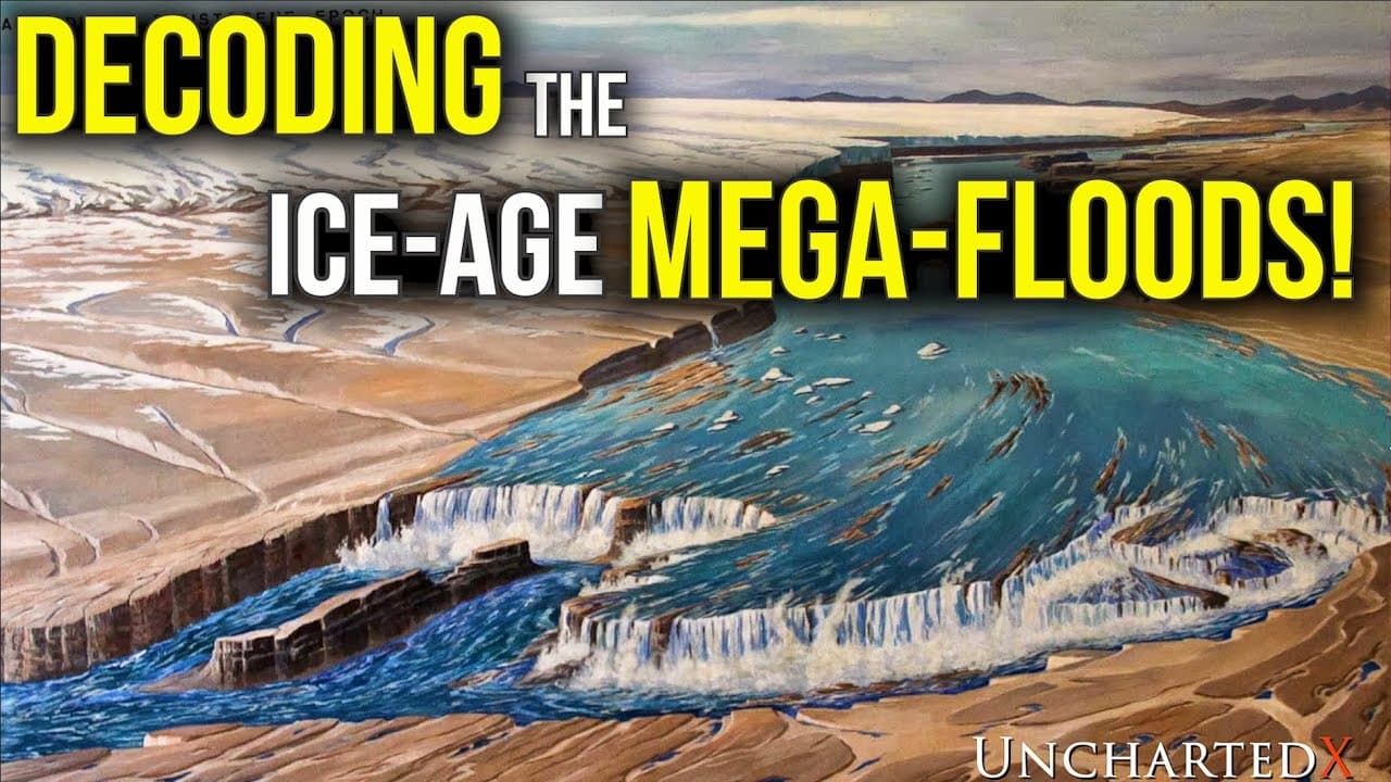
MegaFloods shaped the Channeled Scablands by sending immense volumes of water through coulees, cataracts, basins, and valleys. High-water marks indicate that roughly 800 million cubic feet per second flowed through one valley, about 20 times the combined flow of every river on Earth. The landscape also preserves archaeological and paleontological clues from the Pleistocene, making it worth reading on to see how these connected forms reveal a larger mystery.
Transcript
yeah i mean this can be here so that people know that who's in charge around here [Applause] [Applause] so you know it's a lie i need you and your reason why all over the north american continent are found to be an assortment of features that are difficult it's not impossible to explain by reference to modern currently observable processes and when... Read More
Key Insights
- 🤑 The extraordinary landscapes of North America are rich in geological, archaeological, and paleontological wonders.
- 🤽 Water played a crucial role in shaping these landscapes, with flooding events leaving behind distinct features.
- 🌍 Explorers are on a trail of evidence, following a mystery that can alter our understanding of the world and humankind.
- 💁 The study of these landscapes involves analyzing geological formations, archaeological sites, and fossil records.
- 🌎 The lost world of the Pleistocene, once prevalent in North America, holds important clues for understanding past events.
- 💋 High water marks help estimate the scale of historic flooding events, with some floods surpassing the combined flow of all Earth's rivers.
- 🌎 Different regions, such as Telford Scabland, Grand Coulee, and Quincy Basin, contribute to the overall story of North America's landscapes.
Install to Summarize YouTube Videos and Get Transcripts
Explore YouTube Video Summarizer or Get YouTube Transcript Extractor
Questions & Answers
Q: How did megafloods shape the Channeled Scablands?
Enormous floods sent water through valleys, coulees, channels, and basins, creating features such as cataracts, giant eddy bars, and current ripple trains. Together, these landforms preserve evidence of events that are difficult to explain through currently observable processes alone.
Q: How much water flowed through the Channeled Scablands during the Missoula flood?
Using high-water marks and the valley’s shallow southward gradient, Victor Baker calculated a flow of about 800 million cubic feet per second. The transcript describes this as roughly 20 times the combined flow of every river on Earth.
Q: What evidence reveals the scale of the Missoula flood?
High-water marks on mountainsides show how high the floodwaters reached. Victor Baker combined those marks with the valley gradient to estimate the volume of water flowing through the area.
Q: What happened at the former waterfall near Upper Coulee?
Where the monocline and Upper Coulee converge, an extinct waterfall once stood about 900 feet high and a mile wide. Water descended there and then spread outward into the surrounding landscape.
Q: How did floodwater move through Quincy Basin?
Water entered and filled Quincy Basin from multiple directions, including flows associated with Grand Coulee, Drumheller Channels, and Banks Lake. As the water rose, it spilled over several outlets and drained toward features including Sentinel Gap.
Q: Which Channeled Scablands locations help tell the flood story?
The transcript identifies Telford Scabland, Grand Coulee, Quincy Basin, Drumheller Channels, Potholes Cataract, Frenchman Coulee, Crater Coulee, West Bar, Moses Coulee, and the Columbia Valley. Their connected channels, spillways, and ripple formations trace how floodwater moved across the region.
Q: Why does exploring the Channeled Scablands resemble solving a mystery?
The exploration follows a trail of physical evidence rather than focusing only on scenery. Coulees, cataracts, giant eddy bars, ripple trains, archaeological sites, and fossils must be interpreted together to decipher the landscape’s preserved story.
Q: How are geology, archaeology, and paleontology connected in the Channeled Scablands?
The tours treat geology, archaeology, and paleontology as three primary but overlapping areas of interest. Geological context helps explain evidence involving former inhabitants and Pleistocene animals, including thousands of mammoths, giant ground sloths, and packs of dire wolves.
Summary & Key Takeaways
-
North America is home to a collection of extraordinary landscapes that defy comprehension and require further exploration.
-
These landscapes hold clues and evidence of past events that have the power to reshape our understanding of the world and humankind.
-
By studying the geological formations, archaeological sites, and fossil records, we can begin to unravel the complex story hidden within these landscapes.
Read in Other Languages (beta)
Share This Summary 📚
Summarize YouTube Videos and Get Video Transcripts with 1-Click
Try YouTube Summary with ChatGPT & Claude or YouTube Transcript Generator
Explore More Summaries from UnchartedX 📚



Summarize YouTube Videos and Get Video Transcripts with 1-Click
Try YouTube Summary with ChatGPT & Claude or YouTube Transcript Generator