Why Is the Pacific Ring of Fire So Prone to Volcanoes, Earthquakes, and Tsunamis?
TL;DR
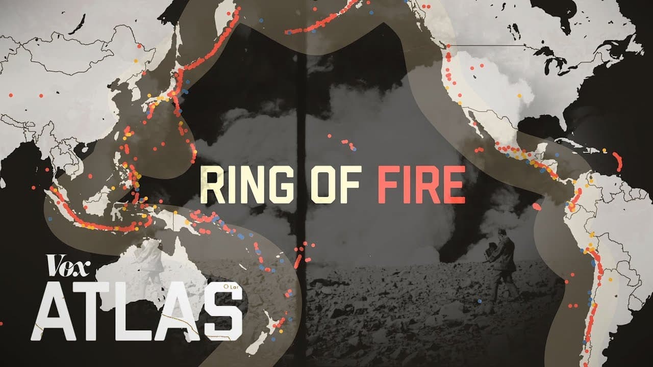
The Pacific Ring of Fire experiences so many natural disasters because fast-moving tectonic plates collide or grind past one another around the Pacific Ocean. This 40,000-kilometer belt contains hundreds of volcanoes and is where most of the world’s earthquakes and tsunamis occur. Because scientists cannot predict exact timing or severity, preparedness remains crucial, and the evidence ahead explains both the danger and the available protections.
Transcript
"Offer a magnificent view of nature's greatest power display." Mount Mayon in the Philippines erupted in January. It continued for over a month. In February, Mount Sinabung erupted in Indonesia. Here’s the ash cloud as seen from space. And in June an eruption in Guatemala killed more than 100 people. Turns out this is pretty normal. On average, th... Read More
Key Insights
- Eruptions reveal the concentration: Mount Mayon erupted in January for over a month, Mount Sinabung erupted in February, and Guatemala experienced a deadly eruption in June. These events were geographically separate, but their positions helped illustrate the larger Pacific pattern rather than an unusual short-term cluster in one country.
- Constant activity is normal: At any given time, an average of 10 to 20 volcanoes are erupting around the world. Adding volcanoes that are currently quiet to a map makes the Pacific concentration clearer. The Ring of Fire therefore describes a persistent geological distribution, not merely the locations of a few recent eruptions.
- The belt spans enormous distance: The Ring of Fire extends for 40,000 kilometers and includes hundreds of volcanoes along the Pacific Ocean’s edges. It also contains the locations of most earthquakes and tsunamis. Its scale helps explain why the danger affects numerous countries and cannot be addressed as a single local hazard.
- Early maps captured the pattern: Explorers and scientists began grouping volcanoes during the 1800s. An 1852 map identified the volcanic series of Australia and the volcanic series of Japan and Kamchatka in Russia, effectively marking the wider Ring of Fire before scientists had agreed on the physical mechanism behind it.
- Plate tectonics supplied the explanation: By the 1960s, most scientists concluded that Earth’s surface is divided into tectonic plates that move slowly into and apart from one another. Comparing the Pacific plates with mapped eruptions and earthquakes showed that much of the activity occurs where those plates meet and crash together.
- Pacific plates add extra stress: Plates around the Pacific move faster than plates elsewhere in the world. Their movement adds stress at interaction zones, helping generate frequent volcanic and seismic activity. Each boundary interaction operates independently, but together they form what the transcript calls the world’s most seismically active region.
- California illustrates lateral movement: At the San Andreas Fault, the Pacific plate grinds past the North American plate instead of simply crashing into it. That motion produces thousands of earthquakes each year. Most are not described as seriously damaging, but the 1989 San Francisco-Oakland earthquake killed 63 people and injured nearly 4,000.
- Volcano monitoring has boundaries: Geologists watch tremors, gas emissions, and temperature changes around volcanoes to estimate when eruptions might occur. These observations can indicate changing conditions, but they cannot establish the exact timing or severity. Monitoring therefore supports preparation without providing certainty about a coming eruption.
- Earthquakes offer fewer signals: Earthquake forecasting is even weaker because earthquakes are not preceded by warning signs that allow geologists to see them coming. Scientists can estimate longer-term regional risk from past events, but they cannot identify the precise moment when the accumulated movement and stress will produce a damaging quake.
- History produces probability estimates: New Zealand faults have experienced earthquakes every 500 to 1,000 years, supporting concern about another mega quake. Northern California has a 72% chance of a major earthquake within 30 years. Parts of Japan have a 25% chance of a big quake, while a Seattle event within 50 years could affect 7 million people.
- Japan demonstrates practical mitigation: Japan’s warning system provided a full minute of notice before the 2011 tremor. It stopped high-speed trains and factory lines and delivered countrywide text alerts. Alongside required anti-earthquake building designs, these precautions could not prevent the earthquake or tsunami, but they saved lives and limited an already catastrophic outcome.
- Uneven preparation increases danger: Most Ring of Fire countries have some form of anti-earthquake building code, but code quality and implementation differ. Developing countries can struggle to fund protective projects. The transcript also identifies California, Oregon, and Washington as vulnerable, relatively wealthy places that still lacked a public early-warning system, showing that resources alone do not guarantee action.
Install to Summarize YouTube Videos and Get Transcripts
Explore YouTube Video Summarizer or Get YouTube Transcript Extractor
Questions & Answers
Q: Why is the Pacific Ring of Fire so prone to volcanoes, earthquakes, and tsunamis?
The Ring of Fire follows the boundaries of tectonic plates around the Pacific Ocean. These plates crash into one another or grind past each other, producing stress, volcanic activity, and earthquakes. Pacific plates also move faster than other plates, adding stress where they interact. The separate boundaries collectively create the world’s most seismically active region, where most earthquakes and tsunamis occur.
Q: What and where is the Ring of Fire?
The Ring of Fire is a 40,000-kilometer belt of hundreds of volcanoes along the edges of the Pacific Ocean. Most of the world’s earthquakes and tsunamis also occur within this region. Its volcanic areas include locations around Japan, Kamchatka in Russia, Australia, the Philippines, Indonesia, Guatemala, Mexico, and the western coast of North America. The belt reflects where multiple tectonic plates interact rather than one continuous volcanic system.
Q: How does the San Andreas Fault produce earthquakes?
The San Andreas Fault marks where the Pacific plate grinds past the North American plate in California. This continuing movement produces thousands of earthquakes each year. Only some become large enough to cause serious damage, so constant activity does not mean every tremor becomes a disaster. In 1989, the San Francisco-Oakland earthquake killed 63 people and injured nearly 4,000, demonstrating the boundary’s destructive potential.
Q: Can scientists predict Ring of Fire eruptions accurately?
Scientists cannot determine an eruption’s exact timing or severity with certainty. They monitor tremors, gas emissions, and temperature changes around a volcano to estimate when it might erupt. Those indicators provide evidence of changing volcanic conditions, but the signals do not yield a precise forecast. Monitoring is still valuable because an estimate can support preparation even when it cannot guarantee exactly what will happen.
Q: Why are earthquakes harder to predict than volcanic eruptions?
Earthquakes are not preceded by warning signs that let geologists see them coming. Volcanoes at least provide measurable conditions such as tremors, gas emissions, and temperature changes, although those indicators are also uncertain. For earthquakes, scientists rely more heavily on past activity and recurrence patterns to calculate longer-term probabilities. This explains why forecasts describe regional chances across decades rather than a precise date, location, and severity.
Q: What earthquake risks were forecast for Pacific regions?
New Zealand faults have experienced earthquakes every 500 to 1,000 years, with a massive quake over 800 years ago and another around the 500-year mark, leading scientists to believe the country is due for a mega quake. Northern California faces a 72% chance of a major earthquake along the northern San Andreas Fault within 30 years. Parts of Japan have a 25% chance of a big quake. Seattle could experience one within 50 years that might affect 7 million people.
Q: How did Japan reduce the impact of the 2011 disaster?
Japan required buildings to use anti-earthquake designs and operated an earthquake early warning system. Before the 2011 tremor arrived, the system stopped high-speed trains and factory lines and sent text alerts across the country with a full minute of warning. The earthquake and following tsunami still killed 15,000 people and caused $300 billion in damage. The precautions mattered because they saved lives even though they could not prevent the natural hazards themselves.
Q: Why does preparedness vary across the Ring of Fire?
Most countries in the region have some form of anti-earthquake building code, but their quality and implementation vary. Developing countries can have difficulty funding protective projects and warning infrastructure. Wealth does not ensure preparation, since California, Oregon, and Washington were identified as vulnerable states without public early-warning systems. Governments may assign unpredictable volcanoes and earthquakes a low priority, which leaves communities exposed despite certainty that more disasters will occur.
Summary & Key Takeaways
-
A visible global pattern: Eruptions at Mount Mayon in the Philippines, Mount Sinabung in Indonesia, and Guatemala illustrate the recurring activity around the Pacific. The Guatemala eruption killed more than 100 people, while Mount Mayon continued erupting for over a month. Globally, 10 to 20 volcanoes are erupting at any given time on average. Mapping active and inactive volcanoes reveals their concentration along the Pacific Ocean’s edges, forming the 40,000-kilometer Ring of Fire.
-
Finding the underlying cause: Scientists had recognized this broad belt of volcanic activity by the 1800s, as shown by an 1852 map marking volcanic series in Australia, Japan, and Kamchatka in Russia. Agreement about its cause came another 100 years later. By the 1960s, most scientists had concluded that Earth’s surface consists of tectonic plates that slowly move together and apart. Eruptions and earthquakes cluster where the Pacific plates crash into or otherwise interact with neighboring plates.
-
Plate movement creates hazards: Pacific plates move faster than other plates, increasing stress where they interact. One plate moves northwest into the North American plate, producing a line of volcanoes. In California, the Pacific plate grinds past the North American plate at the San Andreas Fault, causing thousands of earthquakes each year. A small number cause serious damage, including the 1989 San Francisco-Oakland earthquake, which killed 63 people and injured nearly 4,000.
-
Forecasting remains deeply limited: Geologists cannot accurately determine when a volcano will erupt or an earthquake will strike. Tremors, gas emissions, and temperature changes can help estimate volcanic activity, but they do not reveal exact timing or severity. Earthquake forecasts are weaker because earthquakes have no preceding warning signs. Scientists instead study recurrence in historical records, producing risk estimates for New Zealand, northern California, parts of Japan, and Seattle without converting those probabilities into precise predictions.
-
Preparedness changes the outcome: Japan’s 2011 earthquake and tsunami killed 15,000 people and caused $300 billion in damage, yet precautions prevented still greater losses. Anti-earthquake building designs and an early warning system stopped high-speed trains and factory lines while sending nationwide text alerts a full minute before the tremor. Elsewhere, building-code quality and implementation vary, funding can be limited, and vulnerable western US states lacked public earthquake warnings, leaving preparedness as the unresolved challenge.
Read in Other Languages (beta)
Share This Summary 📚
Summarize YouTube Videos and Get Video Transcripts with 1-Click
Try YouTube Summary with ChatGPT & Claude or YouTube Transcript Generator
Explore More Summaries from Vox 📚



Summarize YouTube Videos and Get Video Transcripts with 1-Click
Try YouTube Summary with ChatGPT & Claude or YouTube Transcript Generator