How Are Earth Data and AI Moving Into Orbit?
TL;DR
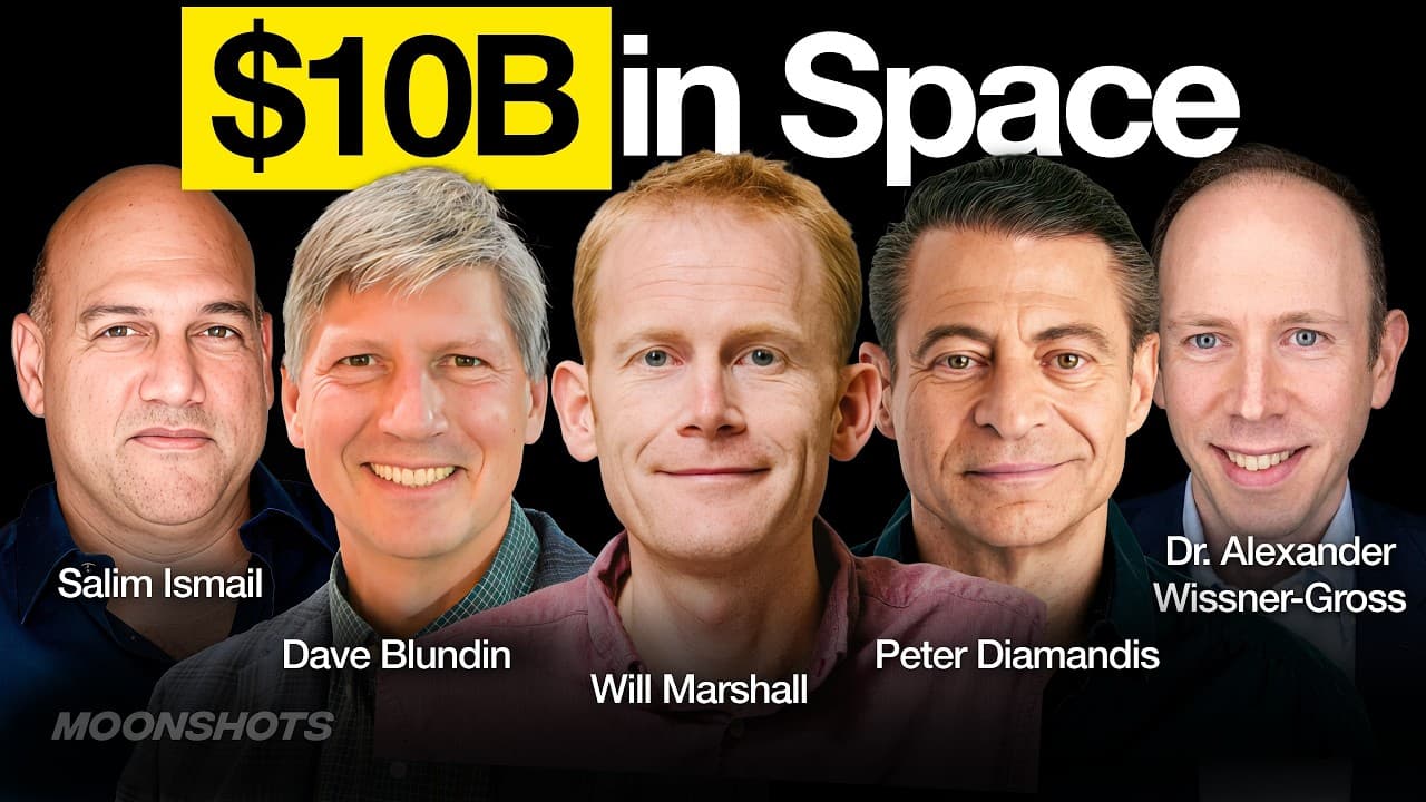
Large earth models combine language models with satellite imagery so users can ask practical questions about changing conditions on Earth. Planet says its daily global imaging archive can support agriculture, disaster response, national security, and historical comparisons, while the longer-term direction is to place AI compute near sensors in orbit and reduce the cost of processing enormous data volumes.
Transcript
Today, Planet's a10 billion company. You've coined the term large earth models. What's that mean? >> Bit like Google index the internet to make it searchable. We're indexing the earth to make it searchable. It will finally enable us to be smart stewards of our planet. >> The elephant in the room here, Will, I have to ask it, is how do you compete w... Read More
Key Insights
- Large earth models are AI systems that combine language models with real-world Earth observations, enabling questions about physical conditions rather than only text-based knowledge. Their usefulness depends on extensive sensor data documenting how locations and activities change over time.
- Planetary intelligence is presented as a progression from sensing Earth in space to processing data closer to orbital sensors. The first phase focuses on integrating imagery with AI models, while the second phase places compute in space to support more advanced capabilities.
- Planet's archive is a historical advantage because it contains about 3,000 images for every point on Earth's land mass over 10 years. A new satellite fleet could collect future observations, but it could not recreate imagery from previous years.
- Daily global imaging makes comparison more useful than isolated observation. Governments, intelligence organizations, farmers, and other customers can determine whether current activity is normal or abnormal by comparing recent imagery with historical patterns from the same location.
- Artificial intelligence reduces the expertise required to use satellite imagery. Instead of manually processing terabytes of data, a user could ask a language model to find relevant images, analyze how a farm changed, and return practical conclusions about possible interventions.
- Planet's imaging system is described as similar to a satellite map with a time axis. Unlike a map layer that may be several years old, Planet says it captures the entire world every day at high resolution and exposes imagery through an API.
- Launch and compute impose different economic constraints on orbital AI. Companies other than SpaceX currently face what the discussion calls a launch tax, while companies outside Nvidia and Google face a compute tax that may become more important over the longer term.
- GLM 5.2 is presented as a Chinese open-weight model that matches or exceeds leading OpenAI and Anthropic models in some cases. The discussion interprets its performance as evidence that Chinese developers are finding cheaper or more efficient approaches to reasoning with additional tokens.
Install to Summarize YouTube Videos and Get Transcripts
Explore YouTube Video Summarizer or Get YouTube Transcript Extractor
Questions & Answers
Q: What is a large earth model?
A large earth model combines a language model with extensive observations of the physical planet. Planet's concept uses satellite imagery and other Earth data so people can ask how real locations are behaving and changing. Unlike a model trained mainly on internet text, it can address practical questions involving agriculture, disasters, national security, environmental conditions, and historical activity patterns.
Q: How does Planet make Earth searchable with AI?
Planet continuously collects satellite imagery and organizes it as a time-based record of the Earth's surface. It then connects that record with AI models capable of locating relevant images, comparing dates, and interpreting change. The goal resembles indexing the internet for search, except the indexed material documents physical places and their development rather than webpages and written information.
Q: Why is historical satellite imagery valuable?
Historical imagery establishes what normal conditions looked like at a specific location, making current observations easier to interpret. Military analysts can compare present activity with previous activity near bases or industrial facilities, while farmers can assess results against earlier seasons or neighboring fields. Planet says its 10-year archive cannot be recreated by competitors because new satellites cannot capture the past.
Q: How can farmers use large earth models?
Farmers can use large earth models to examine how a field has changed over time and evaluate the apparent results of agricultural interventions. AI can locate the relevant Planet imagery, process the satellite data, compare current conditions with historical patterns or neighboring land, and return understandable answers. This shortens a workflow that previously required specialized handling of very large imagery datasets.
Q: How can governments use Planet's satellite data?
Governments can use Planet's data to identify emerging threats, monitor activity, support disaster response, and compare recent observations with historical baselines. The transcript cites work involving European governments, the United States intelligence community, and Ukraine. The value comes from seeing broad areas repeatedly and determining whether activity at military, industrial, or other important locations appears normal or unusual.
Q: Why does Planet's archive create a competitive advantage?
Planet says its archive contains 150 petabytes of data and about 3,000 images for every point on Earth's land mass across 10 years. That time series records daily change and gives customers a baseline for comparison. Even if another organization launched many satellites, it could only collect new imagery and could not recover observations from dates that have already passed.
Q: What is the difference between Earth sensing and orbital compute?
Earth sensing uses satellites to collect imagery and other observations because space provides a broad view of the planet. Orbital compute places data processing closer to those sensors instead of relying entirely on ground-based systems. Planet describes model integration with existing imagery as the first phase, while putting compute beside sensors in space represents a later phase of planetary intelligence.
Q: Why could compute matter more than launch costs for orbital AI?
Launch access is described as the more important near-term constraint because most companies must pay SpaceX to place infrastructure in orbit. Over the longer term, however, the discussion argues that compute may become the larger constraint. Companies outside Nvidia and Google face high dependence on their computing capabilities, and orbital AI requires enough processing power to analyze enormous streams of sensor data.
Summary & Key Takeaways
-
Planet describes planetary intelligence as a new phase of machine intelligence grounded in observations of the physical world. Large earth models would connect language models with Earth imagery, allowing users to ask about farms, disasters, security threats, and environmental change instead of receiving answers based only on text and abstract knowledge.
-
Planet operates about 200 satellites and says it generates 25 terabytes of imagery each day. Its archive contains 150 petabytes and roughly 3,000 images for every point on Earth's land mass across 10 years, providing a historical record that new satellite operators cannot recreate by launching additional hardware today.
-
The broader discussion connects searchable Earth data with orbital computing infrastructure and competition in artificial intelligence. Near-term economics favor access to affordable launches, while longer-term economics may depend more heavily on compute. The episode also highlights China's GLM 5.2 as an open-weight model capable of competing with leading proprietary systems in some cases.
Read in Other Languages (beta)
Share This Summary 📚
Summarize YouTube Videos and Get Video Transcripts with 1-Click
Try YouTube Summary with ChatGPT & Claude or YouTube Transcript Generator
Explore More Summaries from Peter H. Diamandis 📚



Summarize YouTube Videos and Get Video Transcripts with 1-Click
Try YouTube Summary with ChatGPT & Claude or YouTube Transcript Generator