NASA Explorers S3 E1: Seeing Through Smoke
TL;DR
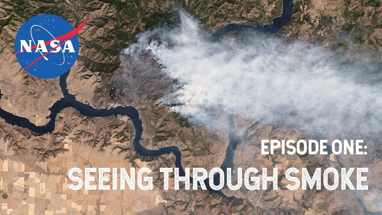
NASA detects and monitors wildfires with satellites that capture images every day and night, giving responders and recovery managers a clearer view of fires and their damage. After the 2018 Camp Fire, NASA satellite data helped map the path of destruction, while a rapid response grant supported research four months after containment. Read on to see how MODIS, VIIRS, climate records, and community partnerships support fire response and risk forecasting.
Transcript
NASA. The Agency that landed on the moon, launched the Hubble Space Telescope, and took the first rover selfie? Yeah, that NASA. We also chase fires. NASA Explorers Introducing Season Three Fires This team is in the middle of a recovery operation. The California Department of Forestry and Fire Protection is using NASA satellite data to map the pat... Read More
Key Insights
- 🕵️ NASA's satellite data is instrumental in detecting and monitoring wildfires, especially in remote areas.
- ❤️🔥 The agency's tools provide valuable information for first responders and fire recovery managers, helping with damage assessment and planning.
- 🥺 Studying wildfires helps us understand their impact on ecosystems and the atmosphere, leading to better management and mitigation strategies.
- ✳️ By analyzing climate data, NASA can predict future flammable landscapes and minimize risks.
- 📌 Collaborating with local communities is essential for understanding and studying remote wildfire locations.
- 🥺 Climate change is leading to more intense and longer-lasting fires, posing new challenges for firefighting and recovery efforts.
- 💦 NASA sends missions into the field to gather data and work with partners to better understand wildfires.
Install to Summarize YouTube Videos and Get Transcripts
Explore YouTube Video Summarizer or Get YouTube Transcript Extractor
Questions & Answers
Q: How does NASA use satellite data to detect and monitor wildfires?
NASA satellites capture images every day and night, often enabling the agency to detect fires and share information early. This coverage provides a clearer picture of fires burning in remote locations and helps map affected areas.
Q: How did NASA support recovery after the 2018 Camp Fire?
The California Department of Forestry and Fire Protection used NASA satellite data to map the Camp Fire’s path of destruction. A NASA rapid response grant also allowed a team to study the fire’s impact four months after it was contained.
Q: What are MODIS and VIIRS used for in wildfire response?
NASA MODIS and VIIRS information can be viewed on Google Earth to examine fire-affected locations. In the Camp Fire example, the imagery made streets and a totally burned-down neighborhood visible, supporting damage assessment.
Q: Who benefits from NASA’s wildfire tools?
NASA provides wildfire tools to first responders and fire recovery managers. The information helps them understand where fires and damage occurred, including in remote areas where observations may otherwise be limited.
Q: What three things are needed to make a fire?
Earth system scientist Doug Morton says a fire needs something to burn, climate conditions that let it start and grow large, and a source of ignition. He adds that the source of ignition today is almost always humans.
Q: How does NASA anticipate which landscapes may become flammable?
NASA uses information about rainfall and climate to anticipate landscapes that may become flammable. This predictive capability can help identify and minimize risks for the next week or even the next season.
Q: What can NASA learn about wildfire impacts from space?
Satellite information shows when and where fires are burning and what changes they are making to ecosystems on the ground and the atmosphere above. NASA’s data record also lets scientists compare daily activity with the same days and similar conditions in previous years.
Q: Why does NASA work with communities near remote wildfire locations?
NASA maps fires across the entire planet, which often leads scientists to remote locations. The agency partners with people who live and work in those communities because they provide an effective way to understand local conditions.
Summary & Key Takeaways
-
NASA uses satellite data to map the path of destruction after wildfires, especially in remote locations.
-
The agency provides tools for first responders and fire recovery managers.
-
They study the impact of wildfires on ecosystems and the atmosphere, helping us anticipate and minimize future risks.
Read in Other Languages (beta)
Share This Summary 📚
Summarize YouTube Videos and Get Video Transcripts with 1-Click
Try YouTube Summary with ChatGPT & Claude or YouTube Transcript Generator
Explore More Summaries from NASA 📚
Summarize YouTube Videos and Get Video Transcripts with 1-Click
Try YouTube Summary with ChatGPT & Claude or YouTube Transcript Generator