How Do Fishing Ships Disappear From Tracking?
TL;DR
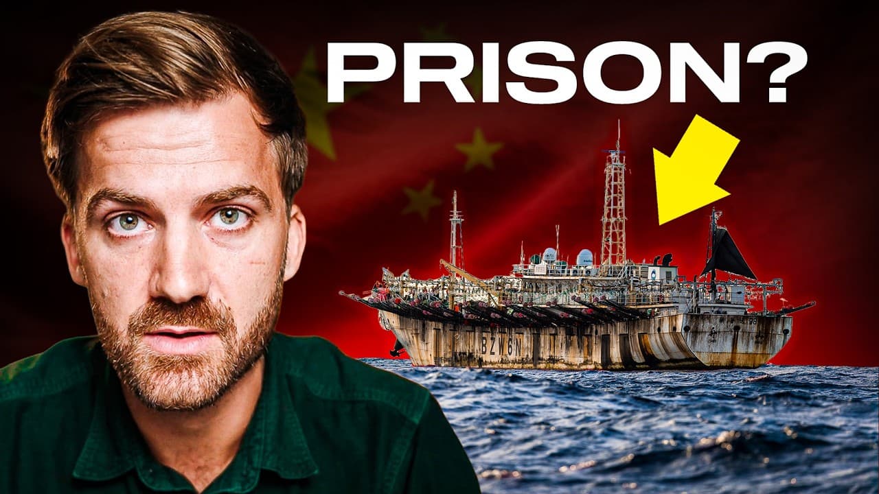
Fishing ships can disappear from public tracking by switching off their Automatic Identification System transponders, creating gaps known as dark activity. Historical AIS records still reveal where vessels vanished and reappeared, allowing investigators to identify patterns near protected waters, including the Galapagos, where a vast concentration of Chinese-flagged fishing vessels operates outside Ecuador’s exclusive economic zone.
Transcript
- [Johnny] Most of our world is hidden in darkness. (light music) This is the deep sea, which is the vast majority of our planet. And even here on Google Earth, we're looking at digitally-modeled shadings of the ocean floor, not pictures of the surface like we have on land. And forever I thought that's because there wasn't much to look at out here.... Read More
Key Insights
- AIS is a maritime tracking system that allows vessels to broadcast their locations, observe nearby traffic, and appear on publicly accessible maps. Aggregated globally, its signals create something resembling air traffic control for the ocean, with extensive real-time detail about ship movements.
- Going dark is the act of switching off a vessel’s AIS transponder so the ship disappears from public tracking. Everything the vessel does while its signal is absent becomes dark activity, although its final transmitted position and eventual reappearance remain visible in historical records.
- AIS transponders can be disabled by a ship’s master despite legal requirements that generally keep them operating. This simple capability creates a major monitoring gap because a vessel can vanish from public view precisely when investigators most want to know what it is doing.
- AIS shutdowns can have legitimate safety purposes because pirates with receivers could use live ship positions like a map of potential targets. A vessel facing piracy may therefore stop transmitting, but it must record the incident in its log and provide an explanation afterward.
- Historical AIS records are investigative evidence because they preserve the boundaries of tracking gaps. The transcript identifies fishing vessels disappearing near Western Africa, an Australian marine reserve, and the Galapagos, showing how investigators can compare dark events across locations and dates.
- Exclusive economic zones are ocean areas where individual countries hold the rights to conduct economic activity. Mapping these boundaries alongside fishing tracks helps distinguish vessels operating in international waters from those entering nationally controlled or protected areas.
- The Galapagos region is both a protected marine area and a habitat containing valuable seafood, including sharks, jumbo flying squid, and skipjack tuna. AIS mapping shows substantial fishing activity immediately outside Ecuador’s exclusive economic zone rather than within its visible protected waters.
- Chinese-flagged ships form an exceptionally large and concentrated fishing presence outside the Galapagos exclusive economic zone. The investigation describes this fleet as the biggest, most centralized, and most powerful fishing effort in human history, visible at night like a city of illuminated vessels.
Install to Summarize YouTube Videos and Get Transcripts
Explore YouTube Video Summarizer or Get YouTube Transcript Extractor
Questions & Answers
Q: What is the Automatic Identification System for ships?
The Automatic Identification System, or AIS, is the principal system described for tracking ship locations. It lets vessels see surrounding maritime traffic while allowing other vessels and observers to see them. When AIS signals are placed on a global map, they provide extensive real-time detail resembling air traffic control for the ocean. The resulting records can also support later investigations of vessel movements.
Q: How do fishing ships disappear from public tracking?
Fishing ships disappear from public tracking when their masters switch off their AIS transponders. Although these devices are generally required to remain active, the equipment can be disabled with a button. The vessel then vanishes from the public map until transmission resumes. Investigators call the disappearance going dark and describe actions during the missing interval as dark activity.
Q: Does switching off AIS always indicate suspicious activity?
Switching off AIS does not always indicate suspicious activity because a vessel may face a genuine piracy threat. Pirates equipped with AIS receivers could use live location broadcasts to find cargo ships, making temporary disappearance a safety measure. However, a vessel that disables its transmitter for this reason must document the event in its log and explain the circumstances in a later report.
Q: How can investigators study ships after they go dark?
Investigators can examine historical AIS records to identify the vessel’s last transmitted location before a gap and its first location after transmission resumes. Those two positions provide context about where the ship traveled while unobserved. By aggregating many disappearances, filtering the records, and comparing locations, investigators can identify recurring patterns near marine reserves, national maritime boundaries, and fishing grounds.
Q: What are exclusive economic zones in the ocean?
Exclusive economic zones, or EEZs, are described as ocean borders within which a country has the exclusive right to conduct economic activities. Adding these boundaries to AIS maps helps investigators determine whether fishing vessels are operating inside nationally controlled waters or immediately outside them in international waters. This comparison is particularly important around protected and economically valuable marine regions.
Q: Why is fishing activity concentrated near the Galapagos Islands?
The waters around the Galapagos Islands contain valuable marine life, including sharks, jumbo flying squid, and skipjack tuna. Ecuador’s exclusive economic zone surrounds the archipelago, and the area also includes protected marine waters. AIS data shows substantial fishing activity clustering just beyond the EEZ boundary in international waters, where foreign vessels can remain close to these valuable resources.
Q: What does AIS data reveal about Chinese fishing vessels near the Galapagos?
When global fishing records are filtered by vessel flag, AIS data reveals a large concentration of Chinese-flagged ships immediately outside Ecuador’s exclusive economic zone around the Galapagos. The investigation characterizes this gathering as the biggest, most centralized, and most powerful fishing effort in human history. Nighttime footage shows so many illuminated ships that the fleet resembles a city skyline on the water.
Q: Why are dark fishing vessels difficult to monitor?
Dark fishing vessels are difficult to monitor because public tracking depends heavily on signals transmitted by equipment that crews can switch off. Once a transponder stops broadcasting, observers lose continuous information about the vessel’s route and conduct. Historical records preserve the endpoints of the gap, but they do not directly show everything that happened between disappearance and reappearance, leaving investigators to infer patterns from context.
Summary & Key Takeaways
-
The Automatic Identification System lets vessels broadcast their positions and observe nearby traffic, producing a detailed public map of maritime movement. Although ships are generally required to keep their transponders operating, a ship’s master can switch the equipment off, causing the vessel to disappear from public tracking and creating a period called dark activity.
-
Turning off AIS does not automatically prove wrongdoing because vessels may legitimately hide their positions when piracy threatens their safety. Such incidents must be documented afterward in the ship’s log and explained in a report. Historical AIS data can nevertheless show precisely where a vessel stopped transmitting and where its signal eventually returned.
-
Filtering global AIS records for fishing vessels reveals intense activity near exclusive economic zones and protected marine areas. Around Ecuador’s Galapagos Islands, many vessels operate just outside the country’s maritime boundary in international waters. Mapping their flags exposes a vast, highly concentrated group of Chinese-flagged fishing ships targeting valuable marine resources.
Read in Other Languages (beta)
Share This Summary 📚
Summarize YouTube Videos and Get Video Transcripts with 1-Click
Try YouTube Summary with ChatGPT & Claude or YouTube Transcript Generator
Explore More Summaries from Johnny Harris 📚






Summarize YouTube Videos and Get Video Transcripts with 1-Click
Try YouTube Summary with ChatGPT & Claude or YouTube Transcript Generator